
Elevating Surveyors’ Insights: Unveiling Surrounding Areas with Telescopic Pole Cameras
In this article, we delve into the practical ways through which surveyors leverage cameras affixed to telescopic poles to enrich their understanding of the environment they’re studying.
In the realm of land and property surveying, innovation has consistently paved the way for higher precision and efficiency in daily routines. A ground breaking addition to the surveyor’s toolkit is the telescopic pole camera, a game-changing fusion that grants surveyors unparalleled access to crucial data about the surrounding landscape.
A Fresh Dimension in Daily Surveying:
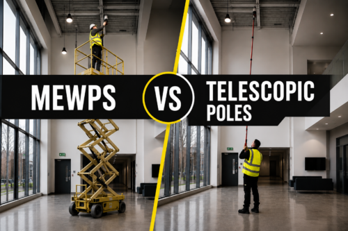
The conventional approaches to surveying often demanded surveyors to conquer challenging terrains and employ costly tools. Telescopic pole cameras dissolve these constraints by presenting a versatile and cost-effective alternative. Crafted from lightweight materials like carbon fibre, these extendable poles can reach impressive heights, enabling surveyors to capture intricate images and videos from vantage points that were once off-limits.

No ladders used to inspect roof lines
Seamless Site Analysis:
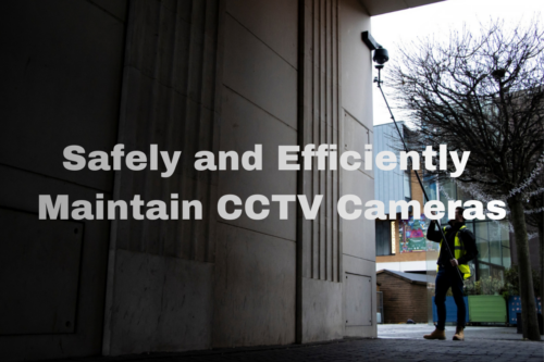
The introduction of telescopic pole cameras transforms site analysis into a streamlined endeavour. Surveyors can now remotely manoeuvre the camera to different angles and elevations, procuring detailed visual data of the land and property under examination. This eradicates the necessity for laborious climbs or the expenditure associated with aerial equipment, making the process notably efficient and significantly safer.
Augmented Data Precision:
Telescopic pole cameras pave the way for precise and accurate data collection, resulting in survey outcomes that inspire trust. By employing top-tier cameras with features such as zoom and pan, surveyors can amass intricate details encompassing property boundaries, topographical features, and potential obstacles. This heightened level of accuracy ensures that the final survey reflects an authentic depiction of the surveyed area.
Simplified Documentation:
The era of jotting down notes and creating hand-drawn sketches on paper is now evolving. Telescopic pole cameras empower surveyors to generate an exhaustive visual archive of the surveyed site. These images and videos seamlessly integrate into digital surveying software, expediting data interpretation and analysis. Furthermore, this visual documentation serves as a valuable aid during client presentations, stakeholder discussions, and legal proceedings.
Safety and Environmental Considerations:
Telescopic pole cameras champion safety and environmental responsibility in surveying endeavours. Surveyors can circumvent potential hazards, navigating treacherous landscapes with grace and ease. This minimizes the risk of accidents and environmental damage that may arise from deploying heavy machinery or disturbing delicate ecosystems.
Tailored to Diverse Surveying Needs:
The utility of telescopic pole cameras transcends specific surveying domains. Whether it involves demarcating land boundaries, evaluating construction sites, conducting environmental impact assessments, or preserving heritage sites, these tools exhibit versatility across multiple surveying disciplines. Surveyors can adapt their strategies to match project prerequisites, resulting in a systematic data collection and analysis process.
As telescopic pole cameras gracefully integrate into the fabric of land and property surveying, they redefine daily routines by enhancing efficiency, accuracy, and overall safety. This innovative amalgamation empowers surveyors to gain fresh perspectives, document finer details, and refine their surveying practices. As the field advances, telescopic pole cameras are poised to be indispensable, heralding a transformative era in the realm of land and property assessment.